Creek

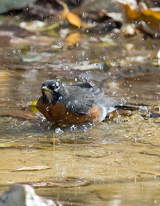
An approximately half-mile stretch of Deer Creek flows through the Litzsinger Road Ecology Center’s property. Despite the fact that Deer Creek is greatly impacted by the urbanization of its surrounding watershed, this riparian area provides important habitat and acts as a travel corridor for an assortment of wildlife species such as deer, coyotes, fox, raccoons, mink, great blue herons, kingfishers, various ducks, turtles, fish, frogs, and macro-invertebrates to name a few. The creek also offers countless opportunities for education. Topics of study can range anywhere from basic stream ecology and understanding watershed principals to raising awareness about water quality and human impacts on our water resources.
The small stretch of Deer Creek that passes through LREC is part of the larger Deer Creek watershed. In fact, if you live anywhere in central St. Louis County, chances are you live in part of this watershed that stretches over an area approximately 23,500 acres in size. Deer Creek is also a tributary of the River des Peres watershed, which is a part of the larger Mississippi River drainage basin. Like most streams in urbanized areas, Deer Creek suffers from a dramatically altered hydrology characterized by flash flood events during times of heavy rains and drying up of its creek bed during dryer parts of the year. This altered hydrology is mainly due to the increase of impervious surfaces, such as roads, parking lots, and rooftops, throughout the watershed, which increases runoff often directed by storm sewer drainage systems channeled straight into the creek itself.
Historically, Deer Creek was thought to be a perennial flowing stream throughout most parts of its watershed. (See pages 5–7 of “An Ecological Survey of the Litzsinger Road Ecology Center, 1992” by Dr. Clifford Ochs in the site inventories portion of Research Studies). Deep-rooted perennial plants with extensive fibrous root systems from native prairie, oak savannah, and oak woodlands that comprised much of the vegetative cover in this area prior to European settlement would have permitted rains to soak into the soil, entering into the groundwater system and slowly charging the creek with water. Flooding events after a heavy rain would have been characterized by a gradual rise and recession of water in the streambed. Today it is forced to transport larger amounts of water and sediment through its banks during large storm events. Hardening of the streambanks and straightening of the channel also contributes negatively to the health of Deer Creek by increasing the velocity of water and disconnecting the stream channel from its floodplain.
As a result of these alterations many of the streambanks along Deer Creek are highly eroded and the stream has become incised and wider in places. Remarkably, Deer Creek still maintains six meanders, or bends, within the stretch of LREC. These meanders represent the natural way in which water tends to flow as it is pulled by gravity, following the path of least resistance. These meanders also serve an important function in the dynamics of the stream by helping to create in-stream habitat such as riffles, runs, and pools.
The U.S. Geological Survey is monitoring the creek at the edge of the LREC property. This Deer Creek data includes gage height, discharge, and precipitation.
Links (links below will open in a new window):
- What’s It Like Where You Live?—Rivers and Streams
http://mbgnet.net/fresh/rivers/ - Missouri Stream Team
http://www.mostreamteam.org - Missouri Watershed Information Network
http://www.mowin.org/ - EPA Watershed Academy Web
http://cfpub.epa.gov/watertrain/index.cfm - The Stormwater Manager’s Resource Center
http://www.stormwatercenter.net/ - The Missouri Department of Natural Resources
http://www.dnr.mo.gov/ - The Nature Conservancy: Missouri Chapter
http://nature.org/wherewework/northamerica/states/missouri/ - Missouri Department of Conservation
http://mdc.mo.gov - Metropolitan St. Louis Sewer District
http://www.stlmsd.com - Soil Water & Conservation District of St. Louis County
http://swcdstl.org/